About the area
The walking area of Stokkem shows you a very diverse river landscape. For bird lovers, the ponds in 'Negenoord-Kerkeweerd’ nature reserve are a must. If you decide on the Stokkem hiking region, you will be treated to flower and herb displays on the dikes, along with old Meuse meanders. The Old Meuse in Dilsen is one of the most striking Meuse meanders in the RivierPark Maasvallei. The town of Stokkem and Oud-Dilsen are anchors in a rich Maasland regional history.
Finally, the charming hamlet of Boyen is situated on the edge of the riverbed in a distinct agricultural environment.
Negenoord-Kerkeweerd
Countless waders, smaller songbirds and species such as yellowhammer, stonechat and nightingale do well here. There are even several flocks of kingfishers breeding. The ponds are surrounded by ecologically rich banks. It is a colourful and herbal patchwork of grasslands, willow woodland and floodplain forest. Limburg's Landschap vzw manages the area. Galloway cattle and Konik horses are used to graze the area.
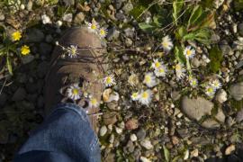
Kerkeweerd is the most species-rich area along the Meuse when it comes to plants. The relief in the landscape, which was created after gravel-extraction and subsequent filling-in, followed by a few floods of the Meuse, features a V-shaped lake. It is located within the river bed and is swallowed up by the Meuse at high tide. That way, all kinds of seeds are brought, which make for a colourful sea of flowers in the spring.
The two lakes of Negenoord are the result of gravel extraction. Thanks to redevelopment works in the context of flood protection by ‘De Vlaamse Waterweg’, the area has been given the best possible opportunities to develop back into ‘wild’ nature. Limburg's Landschap vzw manages the area. This is achieved by using Galloways and Koniks that graze throughout the year and thus manage the development of grasslands, thickets and floodplain forests.
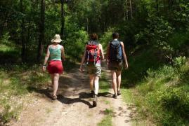
Hiking
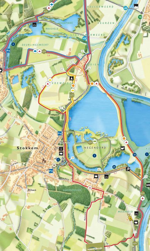
In the Stokkem hiking region, five beautiful loops have been created, each with their own characteristics. The green loop of 2.5 km runs through 'Negenoord' nature reserve and is suitable for wheelchair users and pushchairs.
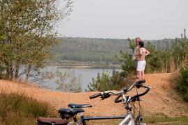
If you feel like strolling in the new river landscape, then the orange (6 km) or red (13.3 km) loops are your best bet. Besides this beautiful river landscape, both loops also take you to the hamlet of Boyen. The red loop combines all the highlights of the hiking area: wild river landscape, ponds with numerous water birds and vast agricultural landscapes.
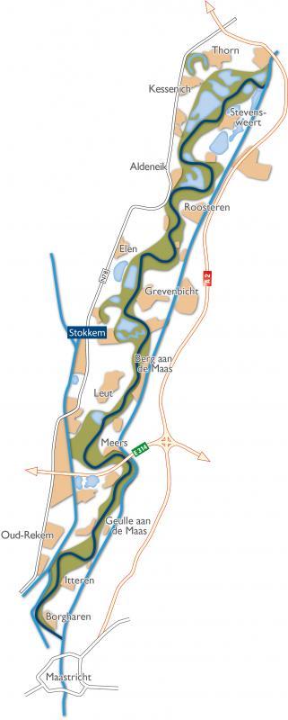
The practical hiking switches allow you to combine different hiking loops in the area without any problems. That's how you put together your own ideal hiking trail. The routes with all the information can be found on the hiking map ‘Stokkem’.
Accessibility and car parks
Starting point
Car Park 10 'Visitor Center De Wissen': Negenoordlaan 2, 3650 Stokkem (Dilsen-Stokkem)
Extra pick-up places
Car Park 9 Oude Maas: Vissersstraat, 3650 Oud-Dilsen (Dilsen-Stokkem)
Car Park 11 Tugelaplein: Tugela, 3650 Stokkem (Dilsen-Stokkem)