About the area
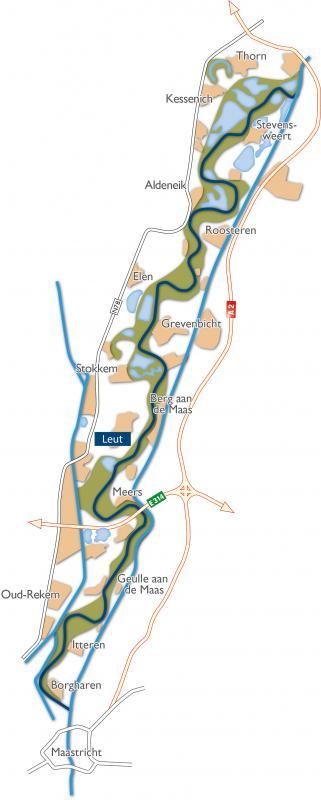
The Meuse and the adjacent nature reserve ‘Maesbempdergreend-Mazenhoven’ form the backbone of the hiking area 'Leut'. At the heart lies the Vilain XIIII Castle with its vast landscaped park. Gigantic trees, unique in size and species, and stately lanes evoke this area’s knightly past. In addition, this landscape contains an extensive variety of typical landscape elements, including hedges, old dikes and orchards. The fact that the Meuse has left its mark on this area is evident from everything you see, from the typical street pattern of the Meuse village Mazenhoven, the Meuse Crucifix in Vucht, right through to the old Meuse meanders and new wild landscapes along the Meuse. The combination of nature and culture make this hiking area a gem to explore on foot.
Maesbempdergreend-Mazenhoven
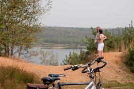
In the nature reserve ‘Maesbempdergreend-Mazenhoven’, a large lake has been created by gravel extraction. In 2010, De Vlaamse Waterweg nv (then nv De Scheepvaart) realised a side channel near Mazenhoven. In the event of high water levels, Meuse water flows through this channel to the lake. In the floodplains along the lake and also in the area of Mazenhoven, there are numerous typical herbs, such as small teasel, meadowrue and oregano. It may look rough, but the area has great natural value. Natuurpunt deploys large grazers to manage the area. The grazing behaviour of Galloway cattle and Konik horses makes for a varied structure.
Limburg's Landschap vzw is responsible for the management of ‘Mazenhoven’, while Natuurpunt vzw looks after ‘Maesbempdergreend’. The cattle and horses are from Limburg's Landschap vzw and are used in both nature reserves. You are free to wander around both areas. Do keep sufficient distance from the grazers, though, as they too appreciate their peace and quiet.
Maaswinkel
More south in the hiking area 'Leut' you will find the nature area ‘Maaswinkel’. The small-scale landscape here finds its origin in the former brickworks. Wells were dug in various places for the extraction of clay to make bricks. These are now a good home for different species of amphibians. Natuurpunt vzw does everything in its power to manage the ponds and has even built additional ones. They also maintain an orchard with tall fruit trees.
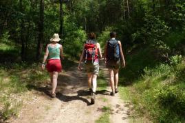
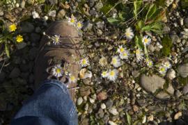
Hiking
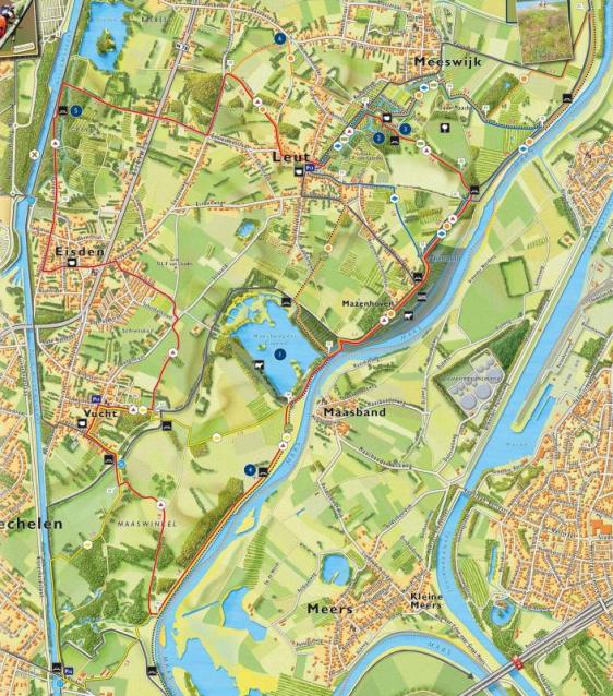
In the hiking region of Leut, five beautiful loops were developed, each with typical characteristics. The green loop of 3 km leads you through the village centre of the historic Meuse village Leut, the monumental castle and landscaped park with special tree collection behind it.
If you feel like strolling along the riverbanks, then it is best to choose the orange (10.2 km) or the red (14 km) loop. The orange loop takes you to the vast nature reserves of ‘Mazenhoven’ and ‘Maesbempder Greend’. A special place on the red loop is 't Greven in Eisden and accompanying ‘Kruinenpad ‘ (tree-top path). In this mining subsidence area (due to former mining activities), groundwater bubbles up. Some of this water is collected for use as drinking water for Limburg families. The story of 't Greven is told on the ‘Kruinenpad’.
Finally, the yellow loop (7 km) takes you along the Meuse Crucifix in Vucht and shows you the unique ‘Maaswinkel’ nature reserve managed by Natuurpunt vzw.
The practical hiking switches allow you to combine different hiking loops in the area without any problems. That's how you put together your own ideal hiking trail. The routes with all the information can be found on the hiking map 'Leut'.
Accessibility and car parks
starting point
Car Park 13 'Dorpsplein': end of Genieskensstraat, 3630 Leut (Maasmechelen)
Extra pick-up place
Car Park 15 'Dorpsplein Vucht': Dorpsstraat z/n, 3630 Vucht (Maasmechelen)
Car Park 16 'Maaswinkel': end of Dokter Haubenlaan, along Zuid-Willemsvaart, 3630 Maasmechelen