About the village
Meers is located on the banks of the river Meuse that bends around the village. Due to the construction of the Juliana Canal in the previous century, Meers became enclosed between this canal and the river. The village is connected to Stein via a bridge. To reduce the risk of flooding, the current channel is being widened and its banks lowered. This will create a new, contiguous nature reserve of at least a thousand hectares.
The Netherlands’ only white-water river lives up to its name in Meers. Traditionally, this place has been one of the more dynamic sections of the Meuse. The river has a sudden and strong decline with a spectacular acceleration to follow. The result is a landscape with spontaneously growing gravel ridges, spectacular erosion whirls and a peninsula with floodplain forest. Meers served as a pilot project for the ‘Grensmaas’ project until 2008 and is now a model area for the other areas. The most striking success has been the return of the beaver who is perfectly able to survive here. Migratory birds are also increasingly appreciative of nature in the Meuse valley.
What is there to do?
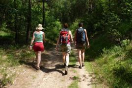
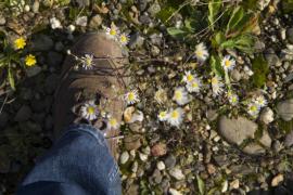
Hiking
The area around Meers is ideal for exploring on foot. For those who like some help to get started, a few tips:
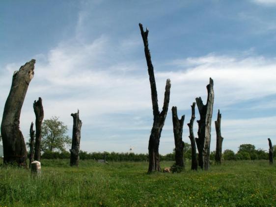
- The Meers - Maasband hiking trail (10 km) from the free brochure Sprankelend Stein (download). En route: Meers tree monument, wild river landscape, large grazers, Leutherhoek.
- Elsloo Catsop poetry trail (6.5 km) from the free brochure ‘Sprankelend Stein’ (download). En route: Chapel along the Kaak, brooks, Catsop, Elsloo castle park.
- The above brochure ‘Sprankelend Stein’ contains more great suggestion trails near Meers, Stein and Elsloo. You can download the brochure free of charge here or from the website of VVV Zuid - Limburg.
- Set off with a Meuse Explorer in tow.
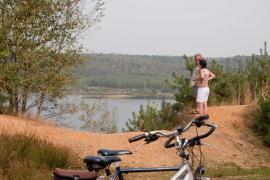
Cycling
Thanks to the extensive cycling route network in Belgium and the Netherlands, you can create your own cycling route using junctions that are indicated in both directions. This way, you can decide which direction you want to go and how long your ride will be. Why not, during your bike ride, take a ferry to the other side of the river Meuse? That way, cross-border cycling in the RivierPark Maasvallei becomes hassle-free. You can join the cycling route network via junction 41 in Stein. You can map out your cycling route using the cross-border map RivierPark Maasvallei.
Visits
- Tree monument 'Woodhenge' in Meers (Koegrienddijkweg 1)
- Tapping point ‘Maasband’ (tapping point for drinking water during the summer months; on the corner of Leutherhoekweg /Maasbanderkerkweg)
- Elsloo castle
- De Fontein brewery
For more information and tips, please visit Visit Zuid - Limburg.